Just a heads-up: this page may contain affiliate links. If you buy through them, we may earn a small commission at no extra cost to you. Learn more.
Whether you’re following a simple route like the Boardwalk Loop in South Carolina or something more rugged, knowing how to read a trail map gives you confidence. But many beginners skip this critical. When your phone signal vanishes and your GPS starts spinning, your paper map might be the thing that gets you back to the trailhead without panic.
Start With the Trailhead Sign
Before you even set foot on the trail, take a moment at the trailhead. Most popular hiking spots have a large posted map showing the loops, trail names, color codes, and any intersecting routes. Take a photo of this with your phone. If there’s a printed map available, grab it.
Understand Trail Symbols
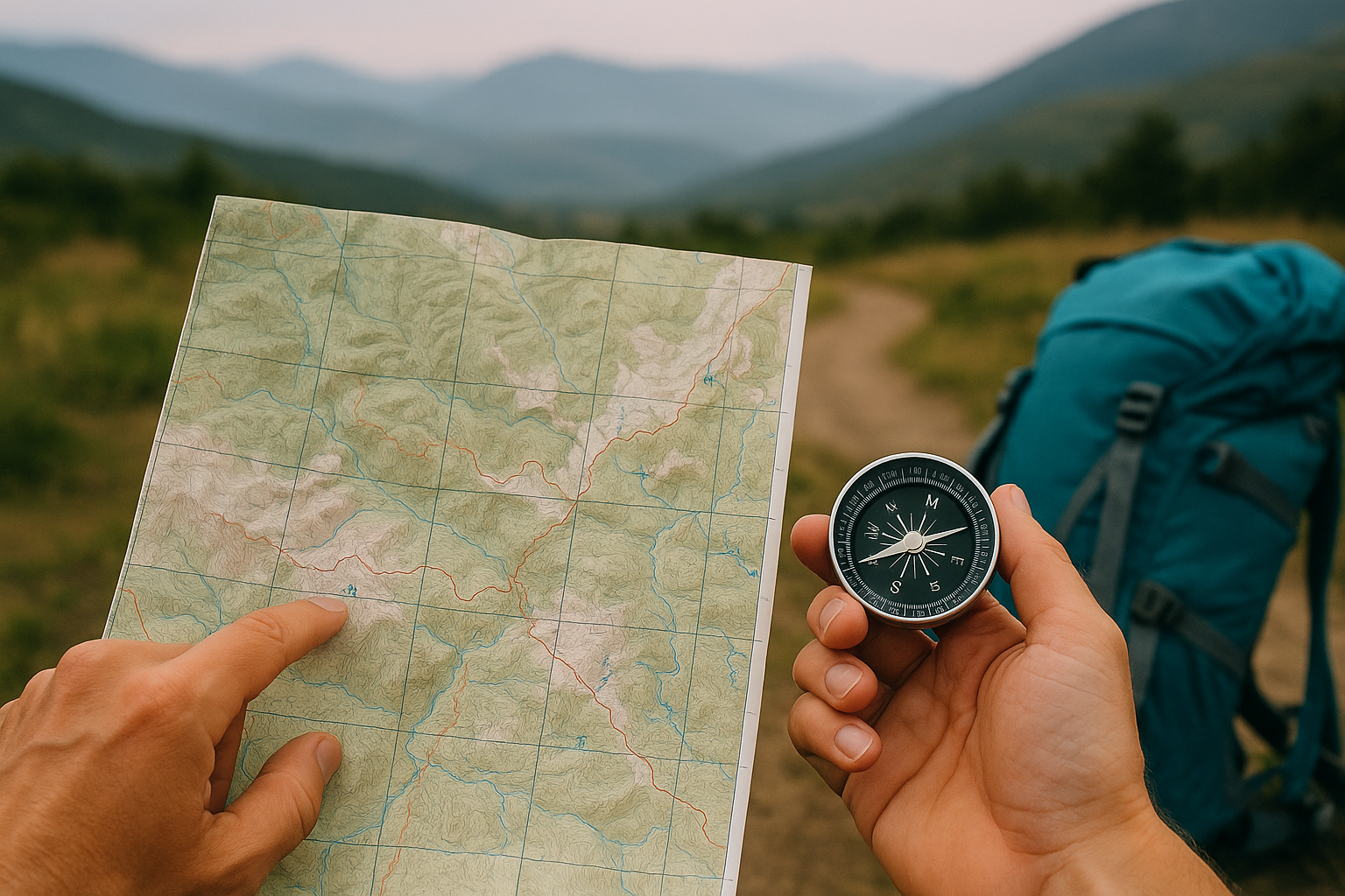
Every map includes a legend or key, usually tucked in the corner. This tells you what the lines, dots, and shapes mean. Solid lines often mark the main trails, while dotted or dashed lines show offshoots or unmaintained paths. Elevation is shown with contour lines—the closer they are, the steeper the climb.
Learn to Gauge Distance and Time
Maps use scale bars to show how distances translate from inches or centimeters to real miles. This helps you estimate how long a hike will take. A good rule of thumb is to plan for around 30 minutes per mile on easy terrain and longer if you’re gaining elevation.
Recognize Trail Markers in the Wild
Once you’re hiking, keep an eye out for blazes—painted markers on trees or rocks. These match the colors on your map. Blue might indicate a water trail or loop, while red usually marks a more strenuous route. Some trails also use numbered signs that correspond with points on the map.
Use Technology Without Relying on It
Apps like Gaia GPS, AllTrails, or Maps.me let you download maps for offline use especially in areas with switchbacks or dense forest, like the Tom McCall Point Trail in Oregon. Still, always bring a backup. Phone batteries die and screens crack.
Know Where You Are, Always
As you hike, glance at your map when you pass junctions, bridges, or notable landmarks. This habit helps you stay oriented and gives you a mental breadcrumb trail to follow back. It’s much easier to recover from a small misstep than to realize you’re completely turned around an hour later.
Map Reading Builds Confidence
Being able to read a trail map means more than navigation. It gives you the freedom to explore new trails, reroute when needed, and feel prepared for the unexpected. The best part? It’s a skill you’ll keep improving every time you hike.